Wildfire Air Quality Monitoring
Create a network of highly accurate sensors to safeguard public health and protect communities during wildfire events. With the Aethair PRO, organizations gain continuous, real-time insights into smoke, particulates (PM1, PM2.5, PM10), carbon monoxide (CO), volatile organic compounds (VOCs), and carbon dioxide (CO2). AI-powered analysis provides early warnings and exposure insights to guide emergency response, while real-time alerts highlight smoke hazards, visibility impacts, and health risks. Aethair data can also be used to evaluate how buildings, HVAC systems, and filtration strategies perform against outdoor pollution, ensuring safer indoor environments when wildfire smoke is at its worst.
Wildfires release harmful pollutants that create serious health, safety, and environmental challenges. Aethair solutions provide continuous wildfire monitoring to:
- Detect Smoke Hazards: Measure PM concentrations to track fire intensity and spread.
- Assess Visibility: Monitor particle levels that reduce visibility and threaten safety.
- Protect Public Health: Identify high-risk pollution events affecting the public.
- Support Emergency Response: Deliver early warnings and data to guide responders.
- Building Performance: Evaluate HVAC & filtration effectiveness against outdoor smoke.
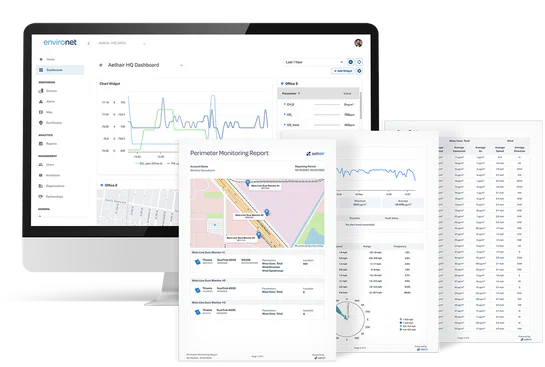
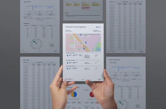
Noesis takes the work out of reporting. Generate customizable reports in seconds for perimeter, indoor, and cabin air quality monitoring. Automatically highlight trends, pinpoint exceedances, and surface insights without sifting through raw data. The result is clear, actionable documentation that saves time, reduces risk, and improves decision-making.
Learn More
With Noesis, wildfire air quality data becomes a tool for proactive protection. Analyze live or historical data, generate custom reports, or review any report created in Environet. With just a few clicks or a simple question, responders and agencies can monitor community exposure, identify exceedances, and support compliance and emergency decisions. Noesis reduces manual workload, saving time and helping protect public health & safety during wildfire events.
Airborne Wildfire Hazards
Wildfires release a mix of harmful pollutants that threaten both outdoor and indoor environments.
- PM1 (Ultrafine Particles): Microscopic particles that reach the bloodstream, linked to cardiovascular and neurological effects.
- PM2.5 (Fine Particles): Smoke particles that penetrate deep into the lungs, causing irritation and long-term health risks.
- PM10 (Coarse Particles): Larger dust and ash particles that irritate the upper airways and reduce visibility.
- Carbon Monoxide (CO): Produced by incomplete combustion, leading to headaches, dizziness, and impaired cognition.
- Volatile Organic Compounds (VOCs): Compounds released in smoke that contribute to toxic exposure and long-term health risks.
- Carbon Dioxide (CO₂): A byproduct of combustion, indicating fire intensity and contributing to greenhouse gas buildup.
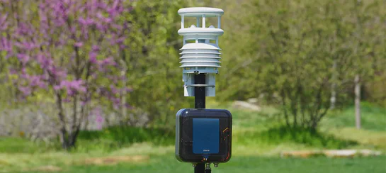
Wildfire Monitoring Hardware
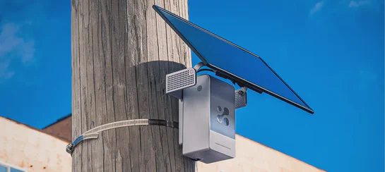
Experience a robust, rugged, and easy-to-deploy real-time monitoring solution that delivers the accuracy and reliability required for critical operations.
- PM1, PM2.5, PM10 Monitoring
- VOC Detection at ppb-level
- Robust all-in-one solution
Thiamis allows you to connect third-party sensors to the Aethair platform, so you can keep using your existing gear while gaining clear, real-time insights.
- Connect 3rd Party Devices to Environet
- Utilize existing monitoring setups
- Reliable global cellular communication
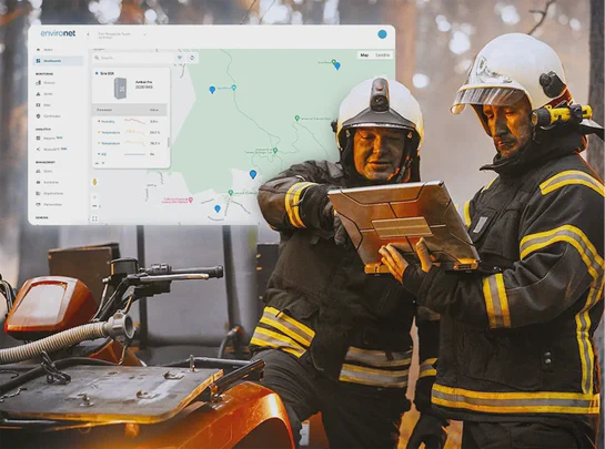
Aethair solutions go beyond detection by turning real-time wildfire air quality data into practical insights. Environet connects field sensors, AI analysis, and cloud reporting so data can be used immediately for response, planning, and protection.
- Community Networks: Deploy sensor arrays to track neighborhood smoke exposure.
- Workplace Safety: Monitor how outdoor smoke affects indoor air and filtration systems.
- Emergency Response: Share real-time data with agencies and first responders.
- Transportation Safety: Track visibility and pollution risks for roads, airports, and rail.
- Public Health Insights: Use long-term exposure data to support health & policy decisions.